
Page 14 - PBCOctober2017
P. 14
Pickwick Bicycle Club Magazine Volume 14 No.2 October 2017 @14
Between 1934 and 1940, the Ministry of Transport would only give fat grants to road-
building schemes if they included wide, protected cycleways on each side of the road. The
MoT was aided in its cycle-friendliness by plans and guidance supplied by the
Rijkwaterstaat, the ministry’s Dutch equivalent. Five hundred miles of such cycleways were
planned. Some of the cycleways were long. For instance, postwar Ordnance Survey maps
show that the 22-mile Southend Arterial Road from Gallows Corner in Romford to
Southend once had cycleways along its full length, and this cycleway linked to others in the
area.
A few of the 1930s-era cycleways are today wholly or partially buried. Others are
hidden in plain sight, not listed by officialdom as cycleways. Many are used as linear car
parks when, in fact, they were originally meant as dedicated routes for people on bikes.
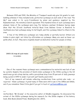
1950’s OS map of cycle tracks
in London
One of the reasons these cycleways were commandeered by motorists was lack of use
by cyclists. Despite the provision of Dutch-style cycleways in the 1930s cycling in the UK
would soon go into steep decline, with a precipitous drop from 25 percent of daily journeys
being cycled in 1949 to under 2 percent just twenty years later.
Part of my research will include collecting recollections from cyclists who rode – or
rejected – these cycleways. A great many of them were still in use in the 1950s and 1960s,
and if you remember them I’d be glad if you got in touch at carltonreid@mac.com
+++
Carlton Reid, “Mr Grundy”, is the executive editor of BikeBiz magazine. He discovered the
extent of the 1930s cycleways during his research for the 1930s chapter of his history
book, Bike Boom (Island Press, Washington DC, 2017).